

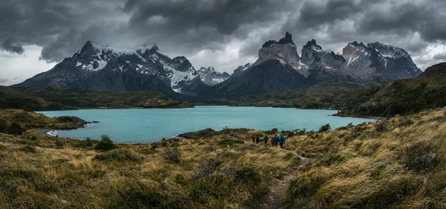
What and Where Is Patagonia?
Patagonia is not a country, a province, or a park — it's a region. Roughly defined, it covers the southern cone of South America below approximately 38°–40° latitude, split between Argentina to the east and Chile to the west. The Argentine side is dominated by vast steppe, Andean foothills, and glaciers; the Chilean side is characterized by fjords, dense temperate rainforest, and rugged Pacific coastline.
The total area is enormous — estimates range from 400,000 to over 600,000 square miles depending on the boundaries used. That scale matters practically: a traveler planning to visit Torres del Paine in Chile and the Perito Moreno Glacier in Argentina in the same week is looking at hundreds of miles of overland travel, border crossings, and limited road infrastructure in between.
For context on how Patagonia fits into broader Latin American travel, this comparison of Buenos Aires, Mexico City, and Bogotá illustrates how differently each destination demands to be planned.
400,000+
Square miles in the Patagonia region
Depending on the boundary definition used, Patagonia covers an area comparable to or larger than the state of Texas and California combined.
770 mi
Length of Chile's Carretera Austral highway
The Carretera Austral runs through some of the world's most remote and least-visited terrain, connecting communities with no other road access.
4–6 months
Advance booking lead time for peak trekking permits
Torres del Paine's official reservation system for refugios and campsites is typically at capacity months before the November–February season.
Seasons, Weather, and When to Go
Patagonia sits in the Southern Hemisphere, so its summer runs November through February and winter from June through August. The "best" season depends heavily on what you intend to do.
- Peak season (Nov–Feb): Longest daylight hours, best trekking conditions, highest crowds, and highest prices. Accommodation and permits book out months ahead.
- Shoulder season (Oct, Mar–Apr): Fewer visitors, unpredictable but manageable weather, and more availability. Many experienced travelers prefer this window.
- Winter (May–Sep): Most facilities in remote areas close. Some roads become impassable. A small number of travelers visit for solitude or winter sports, but this requires serious preparation.
One constant: Patagonian weather changes fast. Sun, rain, sleet, and gale-force winds in a single afternoon is a normal experience — not a bad day. Wind is the defining climate feature, particularly on the Argentine steppe and around the Strait of Magellan.
Pack for Four Seasons in One Day
A moisture-wicking base layer, a mid-layer fleece, a waterproof and windproof outer shell, and sun protection are non-negotiable regardless of season. Patagonian wind alone — regularly exceeding 60 mph on exposed terrain — changes how cold feels dramatically. Do not pack for the weather you hope for.
Key Regions and Access Points
Rather than thinking about Patagonia as one destination, break it into zones:
- Torres del Paine (Chilean Patagonia)
- The marquee trekking destination. Access via Punta Arenas or Puerto Natales. The W Trek and O Circuit require advance permits — often booked 4–6 months out for peak season.
- El Calafate and El Chaltén (Argentine Patagonia)
- El Calafate is the main gateway to Perito Moreno Glacier. El Chaltén is a small mountain village offering day hikes to Fitz Roy and Cerro Torre with no permits required.
- Carretera Austral (Chilean)
- A 770-mile highway connecting Puerto Montt to Villa O'Higgins through some of the most remote scenery in the world. Self-driving or cycling it requires weeks, not days.
- Tierra del Fuego
- Shared by Argentina and Chile at the continent's southern tip. Ushuaia (Argentina) is the primary hub and commonly markets itself as the world's southernmost city.
Book Torres del Paine permits and refugio beds as soon as your dates are confirmed — ideally 5–6 months out for December and January visits. The official reservation system opens to high demand and sells out fast.
Travelers who arrive without pre-booked permits are routinely turned away or forced into inferior itineraries. This is not a recoverable problem once you're on the ground.
Plan your border crossings carefully — some crossings between Argentina and Chile in southern Patagonia operate on limited hours or close seasonally. Confirm current crossing schedules through official sources before finalizing your route.
Border crossing logistics are one of the most common sources of lost travel days in Patagonia, particularly on routes between El Calafate and Puerto Natales.
Culture, People, and Local Context
Patagonia's human story is layered. The region was home to Indigenous peoples — including the Mapuche, Tehuelche, and Selknam — long before European exploration in the 16th century. Their descendants remain present in both Argentina and Chile, though the historical displacement of these communities was often violent, a reality the region's tourism industry does not always foreground.
Today, Patagonian towns like Puerto Natales, El Calafate, and Coyhaique have tourism-oriented economies but retain genuine local character. Gaucho culture — the South American cowboy tradition — is visible on estancias (ranches) on the Argentine side, and sheep farming still defines much of the rural economy.
Spanish is the dominant language on both sides of the border. In smaller towns and on remote routes, English proficiency is limited. Basic Spanish phrases for accommodation, food, and directions will meaningfully improve your experience.
“Patagonia is not a place you can rush. The distances, the weather, and the terrain demand that you build time into your plan — not just for the hikes, but for the unexpected.”
— Travel Smart Editorial Team, Research-based travel content team focused on helping US travelers plan confidently
Logistics: Getting Around and Setting Realistic Expectations
Getting to Patagonia involves flying into one of several gateway airports: Punta Arenas or Puerto Montt in Chile, or El Calafate in Argentina. From Santiago or Buenos Aires, these are typically 3–4 hour domestic flights. There is no continuous road connection between many key sites — expect a combination of flights, buses, ferries, and long overland transfers.
Rental vehicles give flexibility on the Carretera Austral and around Tierra del Fuego, but roads are often unpaved and conditions vary by season. Ferry services connect several otherwise inaccessible points along the Chilean fjords.
Infrastructure Is Genuinely Limited in Remote Areas
Cell service, reliable electricity, and medical facilities are sparse across much of Patagonia's backcountry. In an emergency, evacuation can take hours or days. Travel insurance that specifically covers remote wilderness evacuation is strongly worth considering — verify the terms and coverage limits carefully before purchasing.
Budget conservatively. Patagonia is not a cheap destination even by South American standards. Accommodation in gateway towns fills fast in peak season, and basic services in remote areas carry premium prices due to supply chain logistics.
For a structured approach to sequencing your planning — from destination research through departure logistics — see our guide to the anatomy of a well-planned trip. More general planning resources are also available through the Travel Smart planning hub.
Trip Planning Essentials
A few practical items that catch first-time visitors off guard:
- Permits: Torres del Paine trekking permits, campsites, and refugio bunks require advance booking through the park's official reservation system. Do not assume walk-up availability in peak season.
- Currency: Both Chilean pesos and Argentine pesos are required — they are not interchangeable. ATM availability is limited in small towns; carry sufficient local currency.
- Health and safety: Altitude is not a major factor in most of Patagonia, but exposure risk from cold, wind, and rapidly changing conditions is real. Hypothermia risk on multi-day treks should be taken seriously. Consult a travel medicine professional before departure for any vaccination or health recommendations specific to your itinerary.
- Entry requirements: Visa and entry rules differ between Argentina and Chile. Verify current requirements through each country's official immigration authority and your own government's foreign travel advisory before booking.
Entry Requirements Change — Verify Before You Go
Visa and entry rules for both Argentina and Chile are subject to change and differ depending on your nationality. The information in this article is general in nature. Always confirm current requirements through each country's official immigration authority and your own government's travel advisory well in advance of travel.
CONAF – Torres del Paine Official Reservations
Chile's national forestry agency manages official permits, campsite bookings, and refugio reservations for Torres del Paine National Park. This is the authoritative source for permit availability.
U.S. State Department – Argentina & Chile Travel Advisories
Official U.S. government travel advisories for Argentina and Chile, including entry requirements, safety information, and health recommendations current at time of travel.
Patagonia Road Condition Resources
Chile's Dirección de Vialidad and Argentina's road authorities publish seasonal road condition updates for routes including the Carretera Austral — essential for self-drive planning.
The content on this site is for informational purposes only and is not a substitute for professional advice. Always consult a qualified professional for guidance specific to your situation.